
India News | Cyclone Arnab, Western Disturbance Trigger Rain, Snowfall Forecast in Himachal; Temperatures Dip Below Normal
Get latest articles and stories on India at LatestLY. The impact of Cyclone Arnab and a Western Disturbance has brought light to moderate rainfall to several parts of Himachal Pradesh, while higher reaches of the state are witnessing conditions favourable for light snowfall, particularly in Kinnaur, Shimla and Lahaul-Spiti districts, the India Meteorological Department (IMD) said on Friday.

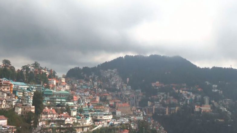
Shimla (Himachal Pradesh) [India], October 30 (ANI): The impact of Cyclone Arnab and a Western Disturbance has brought light to moderate rainfall to several parts of Himachal Pradesh, while higher reaches of the state are witnessing conditions favourable for light snowfall, particularly in Kinnaur, Shimla and Lahaul-Spiti districts, the India Meteorological Department (IMD) said on Friday.
According to Sandeep Kumar Sharma, Senior Scientist at IMD Himachal Pradesh, light to moderate rainfall has been recorded in parts of Shimla, Kinnaur, Solan and Sirmaur districts, while isolated high-altitude areas may experience snowfall.
Also Read | PM Narendra Modi Holds Roadshow in Gujarat Banaskantha District (Watch Video).
"Light to moderate rainfall has been reported in some districts, while higher reaches, particularly in Kinnaur and parts of Shimla, may experience snowfall. The weather is expected to remain generally clear in the plains and mid-hill districts over the coming days," Sharma said.
The IMD forecast indicates that plain and mid-hill districts, including parts of Bilaspur, Mandi, Hamirpur and Una, are likely to experience mainly fair and clear weather from October 30 to November 3.
Also Read | Germany News: Merz in Asia Warns Against Weaponizing Trade.
However, higher-altitude areas of Lahaul-Spiti, Kinnaur, Chamba and upper reaches of Kangra may witness occasional light rain or snowfall at isolated places until November 2.
Meanwhile, temperatures across several weather stations in the state have remained below normal during the past 24 hours, with daytime temperatures declining by around 3 to 5 degrees Celsius following the recent change in weather conditions.
Solan recorded a maximum temperature of around 18 degrees Celsius, nearly 8 degrees below normal, indicating a significant drop in daytime temperatures.
The changing weather conditions have also brought a noticeable chill to several parts of the state, particularly in higher-altitude regions, where the possibility of snowfall remains.
The meteorological department, however, expects temperatures in the plains and mid-hill regions to gradually rise by around 2 to 3 degrees Celsius over the next week.
According to the forecast, weather conditions are likely to remain largely stable in the lower and mid-hill areas, while isolated precipitation may continue in higher elevations, particularly over the next two days. (ANI)
(The above story is verified and authored by ANI staff, ANI is South Asia's leading multimedia news agency with over 100 bureaus in India, South Asia and across the globe. ANI brings the latest news on Politics and Current Affairs in India & around the World, Sports, Health, Fitness, Entertainment, & News. The views appearing in the above post do not reflect the opinions of LatestLY)