New World Map: UN Adopts Resolution Promoting Equal-Area Projections Over Mercator
The UN General Assembly adopted an African Union-backed resolution promoting equal-area world maps like Equal Earth to correct the landmass distortion of the Mercator projection, passing with 164 votes in favor. The proposal for a new world map shows countries’ true size relative to one another. Scroll below to know more.

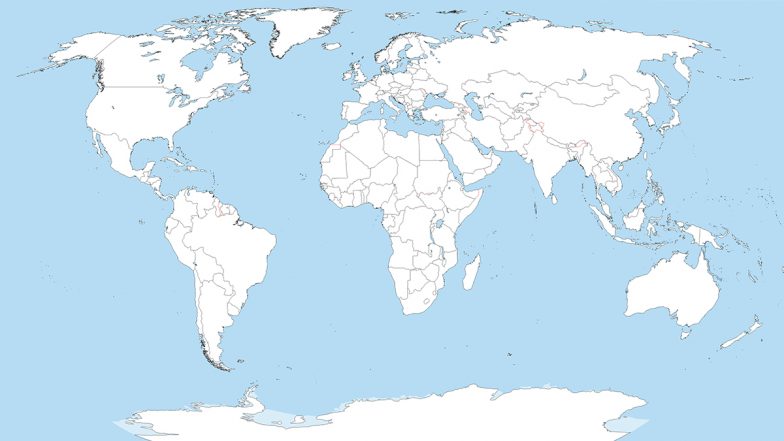
The United Nations General Assembly on Friday, September 4, adopted an African-led resolution promoting world maps (new world map) that more accurately show the relative sizes of countries and continents. The measure, often referred to as the "Correct the Map" resolution, passed with 164 votes in favour, one against and six abstentions. The United States cast the sole opposing vote. Estonia, Georgia, Lithuania, Moldova, Serbia and Ukraine abstained.
Togo sponsored the resolution on behalf of the African Union. It encourages governments, schools, international organisations and technology companies to use equal-area projections, particularly the Equal Earth map, when relative size is important. The resolution is non-binding and does not prohibit the continued use of other projections.
New World Map Standard Backed by UN General Assembly in 164-1 Vote
On Friday, the United Nations General Assembly adopted an African proposal for a new world map, which shows countries’ true size relative to one another.
In favor: 164
Against: 1
Abstentions: 6 pic.twitter.com/5BE4LUiojH
— UN News (@UN_News_Centre) September 4, 2026
Why the Change for New World Map Was Proposed
Most widely used flat world maps rely on the Mercator projection, developed in 1569 by Flemish cartographer Gerardus Mercator for maritime navigation. Straight lines on the map correspond to constant compass directions, making it practical for sailors. The trade-off is significant distortion of area. Landmasses farther from the equator appear increasingly enlarged. On a standard Mercator map, Greenland can look roughly the same size as Africa, even though Africa is about 14 times larger. Regions near the poles, including parts of North America and northern Europe, are similarly magnified relative to equatorial areas.
Official Statement by African Union on Adoption of the 'Correct The Map' Resolution
Communiqué du Président de la Commission de l’Union africaine sur l’adoption de la résolution « Correct The Map »
Le Président de la Commission de l’Union africaine, S.E. M. Mahmoud Ali Youssouf, se félicite de l’adoption, ce jour, par l’Assemblée générale des Nations Unies, de… pic.twitter.com/ICswBcpkj9
— African Union (@_AfricanUnion) September 4, 2026
Congratulations to the delegation of #Togo 🇹🇬 and the Africa Group on the adoption this morning by the #UNGA of resolution A/80/L.104, “Correct the Map.”
First endorsed by the African Union Assembly in February and officially passed at the United Nations today, this… pic.twitter.com/wHxblZ8d3K
— African Union (@_AfricanUnion) September 4, 2026
African governments and advocacy groups have long argued that these distortions contribute to a minimised perception of Africa’s geographic scale and significance in education, media and public understanding. The resolution notes that such representations can affect views of socioeconomic realities, development potential and global balance. In a post on X (formerly Twitter), the African Union said, "For centuries, the Mercator projection distorted global geography, shrinking Africa to the size of Greenland when our continent is actually 14 times larger," as it welcomed the UN General Assembly's decision.
The Equal Earth Alternative
In 2018, cartographers Bojan Šavrič, Bernhard Jenny and Tom Patterson introduced the Equal Earth projection. It is an equal-area design that preserves the relative surface areas of continents more accurately while maintaining a visually familiar overall shape inspired by earlier projections such as the Robinson. Under Equal Earth, Africa appears substantially larger in comparison with high-latitude regions, while Europe, North America and Greenland are shown closer to their true proportional sizes. The projection does not claim perfection - no flat map can fully capture a sphere without some compromise - but it prioritises area fidelity.
The African Union formally endorsed the Equal Earth projection earlier, and Togo advanced the initiative at the United Nations. Togo’s Foreign Minister Robert Dussey told the assembly that maps shape understanding of the world, guide education and influence collective perceptions. “A fair map does not change the geography of the world, it changes how we see the world,” he said.
Reactions and Next Steps
The United States described the resolution as promoting an ideological agenda and a distraction from more pressing issues of peace and prosperity. France, which supported the measure, announced plans to move away from the Mercator projection in its official maps. Supporters, including African Union members, framed the vote as a step toward more accurate and equitable cartographic representation. The resolution explicitly states that it does not challenge the Mercator projection’s continued suitability for maritime and aerial navigation.
Implementation will depend on voluntary decisions by governments, educational systems, publishers and digital platforms. Togo has indicated it plans to update its own school materials. Campaigners hope the strong General Assembly backing will encourage broader adoption of equal-area maps in classrooms, newsrooms and online mapping tools. No single projection can eliminate all distortion when representing a curved planet on a flat surface. Friday’s vote, however, gives formal international support to the principle that maps used for general education and public information should better reflect the actual relative sizes of the world’s regions.
(The above story first appeared on LatestLY on Sep 05, 2026 10:04 AM IST. For more news and updates on politics, world, sports, entertainment and lifestyle, log on to our website latestly.com).